|
Geography
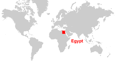
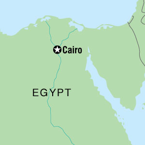
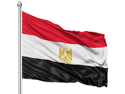
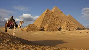
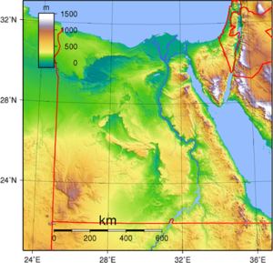
The geography of Egypt relates to two regions: North Africa and Southwest Asia. Egypt has coastlines on both the Mediterranean Sea and the Red Sea. Egypt borders Libya to the west, the Gaza Strip and Israelto the northeast, and Sudan to the south. Egypt has an area of 1,001,449 km2 (386,662 mi2). The climate in Egypt varies from surprisingly cold to extremely hot. Along the northern coast of the country the climate is Mediterranean during winter cool, windy and humid, with occasional rains. Sometimes Mt. Sinai can be covered with snow. Egypt has a population of 86.02 million people. The capitol of Egypt is Cairo. Cairo is the home of 7.772 million Egyptians and is set on the Nile River. Cairo is the largest city in Egypt. Alexandria is the 2nd largest, Giza is the 3rd largest, and Port Said is the 4th largest. The flag of Egypt is a tricolour consisting of the three equal horizontal red, white, and black bands of the Arab Liberation flag dating back to the Egyptian Revolution of 1952. The flag bears Egypt's national emblem, the Eagle of Saladin centered in the white part. This bacame Egypt's official flag on October 4, 1984. Egypt Seasons & Climate. The climate in Egypt varies from surprisingly cold to extremely hot. Along the northern coast of the country the climate is Mediterranean during winter (December through March) – cool, windy and humid, with occasional rains. Sometimes Mt. Sinai can be covered with snow! |
|
